New Proposed Location for Solomon's Temple
by John P. Pratt, V. Garth Norman, Lance Harding, and Jason Jones
Reprinted from Meridian Magazine (15 Aug 2008).
©2008 by John P. Pratt. All rights Reserved.
| 1. Historical Background |
| 1.1 Dome of the Rock |
| 1.2 Dome of the Tablets |
| 1.3 Astronomical Orientation |
| 2. New Proposed Location |
| 2.1 Solomon's Temple |
| 2.2 Formerly Proposed Locations |
| 2.3 Central Axis |
| 2.4 Drainage Channels |
| 2.5 Cisterns |
| 2.6 Pillar Base |
| 2.7 More Research Necessary |
| 3. Conclusion |
| Notes |
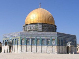
Exactly where was Solomon's temple located? Virtually all investigators agree that it was on the Temple Mount Platform in Jerusalem, but its precise location has been in question.
 |
The evidence presented here was discovered by our team who were sent to Jerusalem last April to research the Temple Mount and surrounding area. Team lead Garth Norman is a professional archaeologist with decades of expertise in archaeoastronomy, Lance Harding is an expert in structural design comparitive study of temples, Jason Jones was our field work engineer and facilitator, having previously lived in Jerusalem, and John Pratt is an astronomer specializing in ancient sacred calendars. The research funding was arranged by Vern Swanson.[1]
1. Historical Background
King David, the father of Solomon, was commanded by the seer Gad to build an altar to the Lord on the threshing floor of Araunah, the Jebusite. David purchased the site and obeyed (2 Samuel 24:11-25). David himself was not allowed to build the temple, but was told that his son Solomon would accomplish that great task (1 Kings 5:5). The magnificent temple was seven years in construction and was finished in King Solomon's eleventh year of reign (1 Kings 6:38).
All tradition and evidence indicate that Solomon's Temple was built at or near David's Altar, atop the hill formerly known to Abraham as Mount Moriah. It is believed that it was the location of Abraham's offering of his son as a sacrifice (Gen. 22:2), and hence the mount is sacred to all believers in Abraham, including Muslims, Hebrews and Christians. The Temple Platform is located near the southeast corner of the old walled city of Jerusalem.
 |
 |
Titus of Rome destroyed Herod's temple in AD 70 so thoroughly that not one stone was left upon another, thus fulfilling the Savior's prophecy (Mat. 24:2).[3] That is what has made it so difficult to locate its precise position on the mount. Rome then erected a temple to Jupiter on the mount, symbolizing the superiority of their pagan gods to the Jewish. It in turn was removed when Christianity was adopted as the official religion of the Roman empire in the fourth century AD. Rather than erect a Christian shrine there, the Romans then allowed the mount to become a garbage dump.
1.1 Dome of the Rock
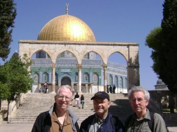 |
Note, however, that the Muslims were concerned about preserving Abraham's sacred Rock altar on Mount Moriah. The Rock may also have been preserved by Solomon to be the altar site for his temple, located southeast of the temple, rather than marking the location of the temple itself.
1.2 Dome of the Tablets
 |
1.3 Astronomical Orientation
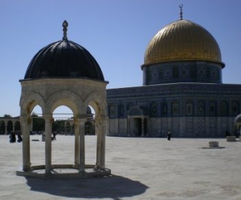
One argument for both of the Dome of the Rock and the Dome of the Tablets has to do with astronomy. When one looks at the long thin layout of Solomon's temple, the astronomer is struck by the fact that it would be perfect for letting the light of the rising morning sun (or moon, planet, or star) shine down its corridors and enter the Holy of Holies on certain sacred occasions.
 |
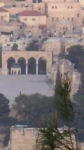 |
Is there any reason to think that the orientation to the Mount of Olives was important? Indeed there is. While there is not much on record about looking from the temple toward the mount, there was a very important ceremony where a priest looked in the opposite direction, from the mount back to the temple. The sacred ceremony was the sacrificial offering of the Red Heifer which was done at a location on the Mount of Olives east of the temple such that when the temple doors were opened the priest would be to be able to see the veil which covered the Holy of Holies. He was said to stand "on top the Mount of Olives" at that time.[8]
Fig. 3 shows the Dome of the Tablets at sunrise on Sat 5 Apr 2008, as seen from very near the peak of the Mount of Olives (from the roof of the Mount of Olives Restaurant, across the street from the Church of the Ascension, said to be located at the peak). Because we were not allowed on the Temple Mount at sunrise to see the sun rise over the Mount of Olives, we felt the next best thing would be to look the opposite direction, from the peak toward the temple. Thus, this picture shows a view similar to what the priest offering the Red Heifer might have seen.
2. New Proposed Location
Our research objectives included several points concerning the Temple Mount and the Mount of Olives. In particular the purpose was to examine certain points of Asher Kaufmann's theory and an extension thereof by Vern Swanson. During that research our team discovered what appears to be significant evidence strong enough to propose yet another location on the Temple Platform for Solomon's temple. Before presenting that evidence, let us briefly summarize some of the key things known about that temple.
2.1 Solomon's Temple
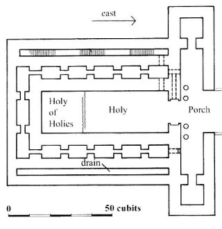
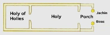 |
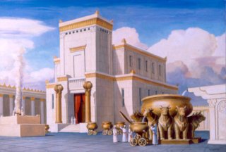
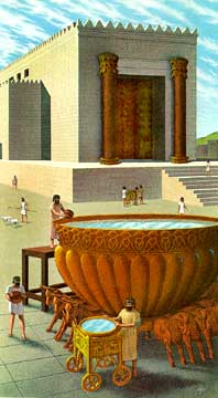
Another point worth noting is that many pictures of Solomon's Temple show it raised up above the platform, as do both of the pictures at the beginning of this article. There is no scriptural basis for that assumption. It is usually made because it has been believed that the temple was situated at the Rock, which would mean that the temple would have to be raised to fit the top of the Rock into the Holy of Holies. Another common idea is that the Holy of Holies itself was raised above the level of the front of the temple for the same reason. Neither assumption finds scriptural support.
 |
2.2 Formerly Proposed Locations
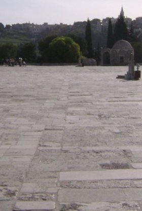
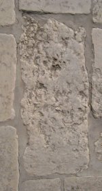
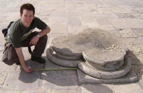
At least twenty locations have been proposed for Solomon's temple. Each was proposed for a different reason to solve different problems and explain various pieces of evidence. A good review of the evidence for each is given in Ritmeyer's book.[9] After having reviewed them all, the authors of this article have not found where their new proposed location has been suggested before. Thus we now present evidence for yet another proposed location.There are at least five reasons for proposing a new location, each of which is clearly visible today. Let us examine each of these reasons.
2.3 Center Axis
 |
 |
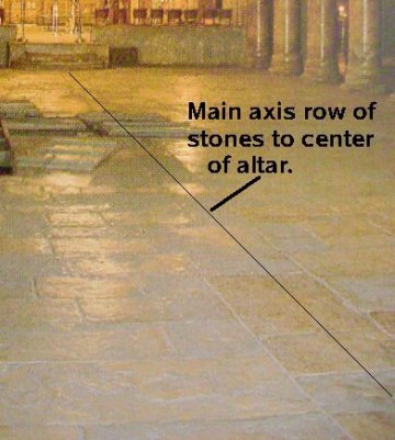 |
As an example of another church having been centered on a single row of stones, look at the photograph of the Church of the Nativity, built by Constantine in AD 335 (see Fig. 8). It also has a center axis indicated in the floor nearly identical to the row of stones we propose as the axis of the temple.
2.4 Drainage Channels
 |
2.5 Cisterns
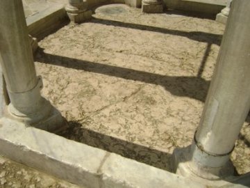
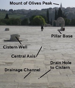
There are large cisterns located beneath this entire area, just as there were beneath the Temple of Solomon. There are holes drilled in the drain channels, to collect the water in the cisterns. One drain hole is clearly visible in Fig. 9, in the center of the west drainage channel. Thus, rain water was collected in them and stored for future use. That exactly matches what was needed for use in sacred washings in Solomon's temple. Thus, these drains and cisterns are just what would be expected to be found at the true location of Solomon's Temple. Also visible in Fig. 9 are three wells, two to the left of the center axis and one very near to what is labeled the pillar base. These wells were built later by the Muslims to get water from the cisterns below, which they also can use for ritual washings. Thus, the drains and cisterns are still working today.2.6 Pillar Base
 |
 |
2.7 More Research Necessary
 |
3. Conclusion
Evidence has been presented for the location of Solomon's temple having been situated between the existing Dome of the Rock and Dome of the Tablets. This evidence consists of 1) a central axis row of stones that may contain original bedrock stones directed nearly perpendicular to the east wall of the Temple Mount, 2) a set of drainage channels on three sides of the location, 3) cisterns located below this area fed by holes in the drainage channels, as would be needed for Solomon's temple, 4) a pillar base in about the correct location for the Boaz pillar, and 5) all of the measurements between these features approximately corresponding to the Biblical dimensions. Thus, it is proposed that this site may indeed have been the original site of Solomon's temple. If this location is indeed correct, then the exact location and orientation have been pinpointed in a place where no building currently stands. Thus the temple could be restored there without impacting the Dome of the Rock in any way.
Notes
- Special thanks go to Ellie Sonntag, Vern Swanson, and Cedar Fort Inc., of Springville, Utah, for funding the trip and research.
- The precise date for the dedication of Solomon's temple has been proposed by one of the authors: Sat 19 Sep 972 BC. See Pratt's "The Timing of David and Solomon's Reigns" Meridian Magazine (12 Nov 2003).
- The date indicated on sacred calendars for the burning of the temple by Nebuchadnezzar is Sun 24 Jul 587 BC, which was 10 Ab (Jer. 52:12) on the Hebrew Calendar and 1 Burning (bpp), the day for burning of Levi and Judah on the Jubilee calendar. In AD 70 the temple was also destroyed on 10 Ab and 1 Burning, on Sun 3 Aug AD 70. See Pratt's "Jubilee Calendar Testifies of Christ," Meridian Magazine (17 Nov 2004), Section 2.5 "Temple Burnings."
- See "Dome of the Rock," in Wikipedia.
- Ritmeyer, Leen, The Quest: Revealing the Temple Mount in Jerusalem (Jerusalem: CARTA Jerusalem, 2006) makes a case for the traditional Dome of the Rock site.
- Kaufman, Asher S. in Proceedings of the International Congress on Biblical Archaeology, A. Biran, ed., (Jerusalem: Biblical Archaeology Today, 1985), p. 484. See also Kaufman, A.S., The Temple Mount: Where is the Holy of Holies? (Jerusalem: Temple of Jerusalem, 2004). Ritmeyer dismisses Kaufman's claim that the floor is bedrock on the grounds that Warren's 1884 estimate put the bedrock perhaps 10 feet lower. He also says it looks like other paving stones, but its size is over a hundred square feet, whereas the nearby stones are rectangles of two to four square feet. Clearly the Dome is there to preserve something important, and it looks to Kaufman and to us that it is to preserve a large patch of original bedrock. Kaufman chooses this location as that of the Holy of Holies of Solomon's Temple. Ritmeyer's other objection to this spot is that Josephus says that the temple was at the "top" of the temple mount. Ritmeyer takes this literally to mean it must have included the Sacred Rock, which projects up from the Mount some 15 feet. To us the less strained interpretation is that the Temple was located on the flat surface of the Temple Platform all of which is atop the Mount. After all, it had been a "threshing floor." See Ritmeyer, p. 163.
- Solomon's Temple is the First, the rebuilding after the exile is called the Second, but neither the Hasmonian restoration nor Herod's expansion is called the Third. That appellation is usually reserved for the future temple. See, for example, Robert Reiland, Jesus and the Third Temple (Silver Springs, NV: Your Own World Books, 2007), which favors Kaufman's theory.
- Middot 2.4 quoted by Ritmeyer, p. 267. See also Karen Boren, Messiah of the Winepress: Christ and the Red Heifer (Beit Parah, 2002).
- Ritmeyer, p. 147 has an illustration of twelve proposed locations for Solomon's temple: De Vogue 1864, Fegusson 1878, Warren 1880, Conder 1884, Schick 1896, Watson 1896, Mommert 1903, Dalman 1909, Mollis 1934, Simons 1952, Vincent 1954, and Ritmeyer 1985. The only one close to the position proposed in this article is the first, that of De Vogue.